Geocomputation, reproducible research and open tools to inform the transition away from fossil fuels
Economics of Low-Carbon Markets workshop
OpenGeoHub
Source: Tidy geographic data course notes from OpenGeoHub 2023, building on Geocomputation with R Lovelace, Nowosad, and Muenchow (2019).
Open source books
For more open source books see bookdown.org 
Economics of Low Carbon Markets
Multidisciplinary event focused on the economics of low carbon markets
Methodological and empirical research
On multiple geographic scales
How can geocomputation help?

Open tools in the wild


Open collaboration

- Any ‘live comments’ welcome (requires a GitHub account), see slides and source code at robinlovelace.net/presenations/oldenburg-2023.html
Why open collaboration?
Open communication + sharing can lead to new collaborations
Cas study: paper with statisticians on modelling transport safety (Gilardi et al. 2022)
![]()

Asking questions in an open forum

GitHub for collaborative research
GitHub is not just for programmers (Braga et al. 2023)

Tools for collaboration
New tools such as Manubot and Quarto make collaboration easier
Source code: https://github.com/manubot/
Example of ‘tracked changes’ in GitHub: github.com/zonebuilder
Now published a fully reproducible paper (Lovelace, Tennekes, and Carlino 2022)


Collaborative writing platorms
Low carbon research

Tools for low carbon transport planning
- Bid for funding outside our comfort zone (2014)
- Development of a prototype tool (2015)
- Lauch of national tool as part of investment strategy (2017)
- Addition of travel to school (2019)
- Extension to Wales, Scotland, Republic of Ireland, Portugal (2020+)

Policy impact

The power of geographic data
Enables understanding of distributional impacts of policies, e.g. agglomeration. Source: Moreno-Monroy, Lovelace, and Ramos (2018)

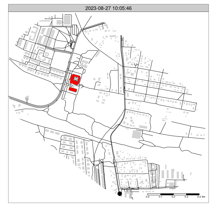
Generating accessibility data

Disaggregating origin-destination data
Souce: Lovelace et al (2022) ‘Jittering: A Computationally Efficient Method for Generating Realistic Route Networks from Origin-Destination Data’.

A larger OD dataset

Resulting networks

Open tools to inform policy
- www.pct.bike
- www.cruse.bike
- biclaR, hosted at biclar.tmlmobilidade.pt
- www.npt.scot
Live demo

Open question
How can Geocomputation be better used to support low carbon economics research?

Source: Morton et al. 2018 ‘Fuel Price Differentials and Car Ownership: A Spatial Analysis of Diesel Cars in Northern Ireland’.