class: center, middle, inverse, title-slide .title[ # The power of open, interactive, dynamic and participatory data in transport planning ] .subtitle[ ##
Smart Transport Conference, Leeds
] .author[ ### Robin Lovelace, University of Leeds ] .date[ ### 2022-05-10 ] --- # Data can make a difference ![](https://github.com/npct/pct-team/blob/master/figures/front-page-leeds-pct-demo.png?raw=true) ??? Mention other speakers: Martin Howell, Director, Transport Markets, UK&I, Worldline Chris Lane, Head of Transport Innovation, Transport for West Midlands Karla Jakeman (STC Chair), Innovation Lead - Connected Transport, Innovate UK --- ## [ActDev](https://actdev.cyipt.bike/): a data driven tool for evidence-based planning <iframe width="560" height="315" src="https://www.youtube.com/embed/nNYroA16JEQ?start=124" title="YouTube video player" frameborder="0" allow="accelerometer; autoplay; clipboard-write; encrypted-media; gyroscope; picture-in-picture" allowfullscreen></iframe> -- Interactive demo: https://actdev.cyipt.bike/ Talbot, Joseph, et al. 2021. ‘Active Travel Oriented Development: Assessing the Suitability of Sites for New Homes’. https://osf.io/7fuq5/ --- .left-column[ ### Too much data? A nice problem to have? Data historically a limiting factor New approaches needed to tackle 'big noise' Boyce, D.E., Williams, H.C.W.L., 2015. Forecasting Urban Travel: Past, Present and Future. ] -- .right-column[ <!-- ![](https://user-images.githubusercontent.com/1825120/167034112-b00e091a-9e2a-4ff3-9e4f-4e71e7fe18f6.png) --> ![](https://user-images.githubusercontent.com/1825120/161992916-2d1dfea6-e783-4b2d-b6b8-61522f38ad8e.png) Lovelace, Robin, Mark Birkin, Philip Cross, and Martin Clarke. 2016. ‘From Big Noise to Big Data' https://doi.org/10.1111/gean.12081. ] ??? - For most of the history of transport planning data scarcity has been a major concern - Now we have an abundance of datasets, many of them incompatible - Concrete example: OD to WPZ data in central London (could ask if anyone knows, it's a mess hehe) --- # 
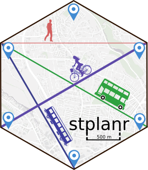
Building new tools of the trade <img src="https://docs.ropensci.org/stplanr/reference/figures/stplanr.png" width="30%" /><img src="https://raw.githubusercontent.com/ropensci/stats19/master/man/figures/logo.png" width="30%" /><img src="https://github.com/Robinlovelace/geocompr/blob/main/images/geocompr_hex.png?raw=true" width="30%" /> -- - Evidence-based policies in government: [Data Science Fellowship at N. 10](https://www.ukri.org/opportunity/esrc-adr-uk-no-10-data-science-fellowships-2021/) ??? - Turing Fellowship - LIDA internship on open transport infrastructure data - Links with DfT, MHCLG, TfNH, international partners -- - Future areas of development: Reproducible Bayesian modelling of proportions (Dirichlet regression), Machine Learning, Decarbonisation Agenda --- .left-column[ ### The future of transport tools Modular Future proof Scalable Vector/ ![](https://user-images.githubusercontent.com/1825120/141863981-31a11068-a5f3-4e19-9471-b03dbb36f9a8.png) Raster/ ![](https://geocompr.robinlovelace.net/02-spatial-data_files/figure-html/raster-intro-plot-1.png) Source: Morgan and Lovelace ([2020](https://doi.org/10.1177/2399808320942779 )) Implementation: [stplanr](https://docs.ropensci.org/stplanr/index.html) ] -- .right-column[ ![](https://user-images.githubusercontent.com/1825120/142071229-81358e26-5e8d-437e-9ef8-91704a4e690f.png)<!-- --> Approach: OD -> Desire Line -> Route -> Route Networks ] ??? I am an all-round data scientist with experience with Python, Julia, and command line tools such as Docker and shell scripting for scalable data science applications. I have particular expertise in R and geocomputation with R in particular. --- ### Discussion: scalability vs resolution Source: [UKRI CREDS project repo](https://github.com/creds2/od-data) ![](https://github.com/creds2/od-data/raw/master/overview_map1.png) --- # Making transport data come to life ![](https://github.com/zonebuilders/zonebuilder/releases/download/v0.0.2.9000/cityscale.png) Source: Lovelace, Tennekes, Carlino ([2022](https://zonebuilders.github.io/zonebuilder/articles/paper.html)) ![](https://user-images.githubusercontent.com/1825120/141021386-3ee6af6d-8ca8-4f4c-9856-c636f4a8fc0e.png) --- class: center, middle # Thanks, look forward to networking + questions 🖧 + 📈 + ✨ = 🚀! -- ## References -- Lovelace, R., Goodman, A., Aldred, R., Berkoff, N., Abbas, A., Woodcock, J., 2017. The Propensity to Cycle Tool: An open source online system for sustainable transport planning. Journal of Transport and Land Use 10. https://doi.org/10.5198/jtlu.2016.862 -- Morgan, M., Lovelace, R., 2020. Travel flow aggregation: nationally scalable methods for interactive and online visualisation of transport behaviour at the road network level. Environment & Planning B: Planning & Design. https://doi.org/10.1177/2399808320942779 -- Lovelace, R., Tennekes, M., Carlino, D., 2021. ClockBoard: a zoning system for urban analysis. https://doi.org/10.31219/osf.io/vncgw -- Lovelace, Robin, Rosa Félix, and Dustin Carlino. “Jittering: A Computationally Efficient Method for Generating Realistic Route Networks from Origin-Destination Data.” OSF Preprints, January 13, 2022. https://doi.org/10.31219/osf.io/qux6g.